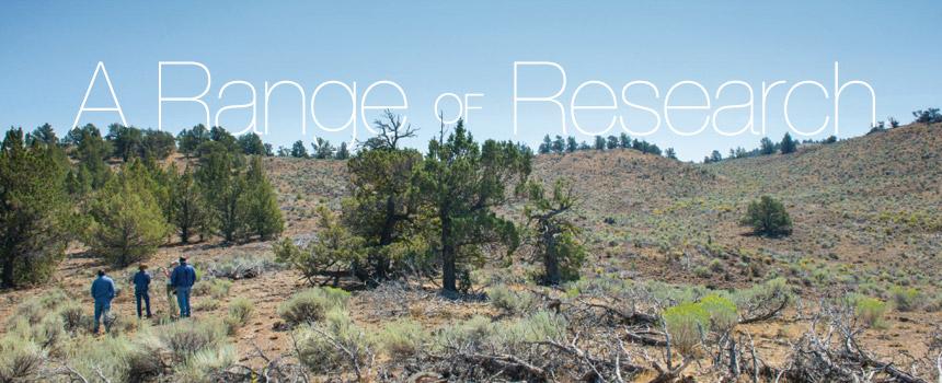
A Range of Research
[caption caption="Keith Nantz (center) demonstrates the pressure of an artesian well on his ranch in Dufur. Carlos Ochoa (left) is helping Nantz measure his cattle's impact on water, plants, and soil. (Photo by Lynn Ketchum.)"] demonstrates the pressure of an artesian well on his ranch in Dufur. Carlos Ochoa (left) is helping Nantz measure his cattle's impact on water, plants, and soil. (Photo by Lynn Ketchum.)") [/caption]
[/caption]
Keith Nantz sees himself like this in a few years: Sitting on a horse watching cows and fat calves as they munch on tall grass on his property. Elk graze nearby; wild turkeys strut by with their young; and a creek with clean water meanders past aspens and pines.
For now, though, he’s looking at acres of weeds and a creek-side fence that needs repair. Nantz wants to maximize the number of cattle grazing on this land but in an environmentally and economically sustainable way. To help him do that, he has invited Oregon State University researchers to his 600 acres near Dufur, just east of Mount Hood, where the hills are a checkerboard of golden wheat fields and green patches of cherry trees.
As his border collies yip down at the creek, Nantz and the researchers stand surrounded by abandoned irrigation pipe and a rusty, old truck. There’s lots of finger tapping as they ponder how to design a study to measure the cattle’s effect on plants, soil, and water.
Nantz’s ranch is a small part of what Carlos Ochoa hopes will be a larger 10- to 20-year study in central and eastern Oregon to better understand how grazing, farming, wildlife, timber harvesting, and even the natural environment affect the quality and quantity of water in creeks. An OSU rangeland scientist who specializes in hydrology, Ochoa wants to know how shade from trees influences the water temperature. How much water do the trees suck up? How does irrigation water that seeps into the soil change the temperature of a stream?
[caption caption="Flowering rabbit brush brightens Oregon’s rangelands and provides sustenance to a great golden digger wasp. (Photo by Lynn Ketchum.)"]") [/caption]
[/caption]
All across the state, OSU’s rangeland scientists are seeking answers to such questions, to help inform policy, boost ranchers’ profits, and strengthen rural economies. They are wading in streams, trekking up hillsides, and scrutinizing everything in between in an effort to restore native vegetation, minimize the impact of wildfires, fight invasive weeds, and keep eastern Oregon watersheds healthy.
After stopping by Nantz’s spread, Ochoa visited Hatfield’s High Desert Ranch near Brothers. There he’s studying the movement of water down two sloping watersheds, where, in 2006, one side was virtually cleared of water-hogging juniper trees and the other side was left wooded. Flow has increased on the side where the trees were cut, and the spring there flows longer into the season. Ochoa is examining the complex relationship between surface and groundwater, and the presence or absence of juniper and other vegetation.
[caption caption="Re-photography of landscapes over time helps range ecologists document slow changes. Lesley Morris, a historical ecologist at OSU, managed to re-photograph this exact spot in southern Idaho to show juniper encroachment from 1868 (top) to 2005 (bottom). (Photo by Timothy O'Sullivan, courtesy National Archives.)"] to 2005 (bottom). (Photo by Timothy O'Sullivan, courtesy National Archives.)") [/caption]
[/caption]
[caption caption="2005 photo shows juniper encroachment. (Photo by Lesley Morris.)"]") [/caption]
[/caption]
Lesley Morris, a historical ecologist at OSU, is looking at changes from the more distant past. She is studying the footprint left by long-ago farming and restoration efforts to help regulators set appropriate goals for managing land that was altered by previous uses. “We may not be able to go into old farmland and plant native species and expect them to grow the way they would in a non-cultivated area,” she says. “What we can expect from those sites might need to change.”
One of Morris’s study sites is the Hells Canyon National Recreation Area in remote northeastern Oregon, home of the deepest river gorge in North America. “It is truly a wicked landscape,” she says. Tenacious homesteaders plowed the land and grazed livestock on terraces along the canyon’s slopes. Morris and graduate student Samantha Pack have dug up records for 52 homesteads and mapped them. They are comparing current vegetation with data from 1981 to document changes in the plant communities. And they have noticed an increase in Ventenata dubia, a weed that is now invading other parts of Oregon, notably the Starkey Experimental Forest and Range near La Grande, where Morris is tracking how it spreads over time.
[caption caption="Old farm equipment once powered by livestock lies idle in the Hells Canyon National Recreation Area, where Lesley Morris is studying how homesteading impacted the land. (Photo by Lesley Morris.)"]") [/caption]
[/caption]
In another study, Morris is investigating how plant communities in Malheur County are faring after sagebrush was plowed under and more than 250,000 acres were seeded with crested wheatgrass, a non-native perennial grass. This was common practice in the 1960s and ’70s, to increase forage for livestock. Morris is measuring how long it has taken for the sagebrush and native grasses to return, if at all, and whether the altered landscape serves as habitat for sage-grouse.
Malheur County is also where OSU’s Sergio Arispe has begun a 6-year study of how grazing affects vegetation that sprouted after a wildfire scorched thousands of acres there in 2012. As part of the project, Arispe will analyze nutrient levels in the plants to determine how much grazing by wildlife and livestock the land can sustain and remain healthy.
[caption caption="Dustin Johnson inspects a clump of crested wheatgrass in one of his research plots near Burns. Although not a native plant, it is desirable as forage for livestock and for revegetating land that has been invaded by annual grasses. His research has shown that crested wheatgrass limits invasive medusahead grass from returning. (Photo by Stephen Ward.)"]") [/caption]
[/caption]
[caption caption="Ricardo Mata-Gonzalez investigates weedy invasives at the Painted Hills unit of the John Day Fossil Beds National Monument. (Photo by Joe Kline.)"]") [/caption]
[/caption]
[caption caption="By comparing water levels in wells, researchers can measure the effect of clearing junipers from the watershed. (Photo by Lynn Ketchum.)"]") [/caption]
[/caption]
[caption caption="OSU graduate student Grace Ray probes the soil moisture at the Hatfield’s High Desert Ranch where Carlos Ochoa is studying the movement of water down two sloping watersheds. (Photo by Lynn Ketchum.)"]") [/caption]
[/caption]
Dustin Johnson is thinking about healthy land, too. Johnson, the co-lead at OSU Extension’s Harney County office, is testing ways to revegetate rangeland that’s been overtaken by medusahead so that the land can be used for grazing and wildlife habitat. Among his strategies is to use natural wildfires to fight medusahead; he found that early summer wildfires followed by seeding perennial grasses in the fall limited the weed’s return.
Johnson is also battling weeds at the Malheur National Wildlife Refuge where reed canarygrass is choking out native plants and growing too densely to provide habitat for small mammals and birds. He’s testing whether cattle grazing and haying can improve the habitat value of areas invaded by the aggressive grass.
OSU’s Ricardo Mata-Gonzalez knows about aggressive grasses. He’s studying factors that affect their survival at the John Day Fossil Beds National Monument, where invasive weeds are muscling out the native grasses. Working in collaboration with the National Park Service, he found that the most robust stands of native bunchgrass grow on steep, north-facing slopes at higher elevations. By knowing this, park authorities can make these slopes a priority for protection in their management plans, he says.
Mata-Gonzalez is also interested in how human use of water might conflict with plants’ needs. “If people use groundwater for homes and agriculture, how much are we impacting rangeland vegetation?” he asks. To answer this, he grew three common rangeland grasses in a greenhouse on campus. All three favored surface water over groundwater, but some were more dependent on surface water, suggesting to Mata-Gonzalez that these grasses would suffer less if there were a shortage of groundwater.
Mata-Gonzalez will go to any length, it seems, to study the relationship between cattle and sagebrush, the habitat vital for sage-grouse. He wants to know how much sagebrush cattle eat, but where to begin? He tested a technique that looks for a plant’s genetic markers in cattle manure. He and a graduate student fed steers different amounts of sagebrush and then had the glamorous job of collecting the cowpats. “They had to be fresh, so we did it very early in the morning,” he says. The method accurately detected the percentages of sagebrush. Mata-Gonzalez also found that the cattle gained the most weight when 5 to 6 percent of their diets consisted of sagebrush; a diet of 9 percent caused them to lose weight.
Back at Nantz’s property, the meeting with Carlos Ochoa is wrapping up. As Nantz takes notes on a clipboard, Ochoa says he’ll run the day’s ideas past other researchers to draw up a plan of action. Nantz tosses the clipboard into his truck, loads up his dogs, and says farewell. He’s one step closer to sitting on that horse, watching his cattle get fat.